Our Services

Remote Sensing & GIS Analysis

Our Remote Sensing and GIS Analysis services empower mineral exploration teams with advanced spatial insights and data-driven decision-making. By combining high-resolution satellite imagery, UAV datasets, and digital mapping techniques, we accurately interpret surface and subsurface geological features, helping define exploration priorities and optimize resource targeting.

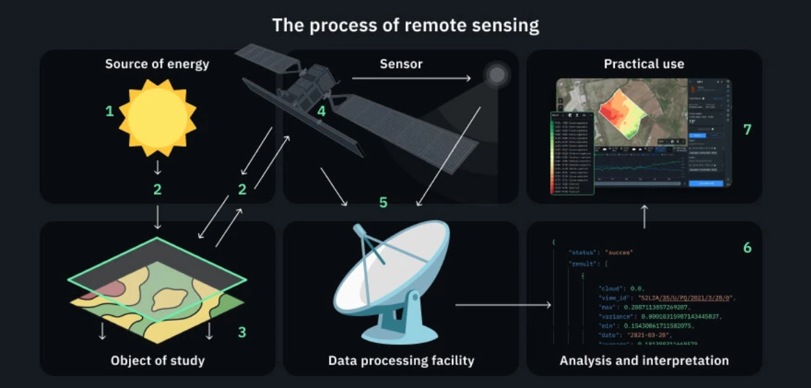
We specialize in satellite image interpretation using datasets from Landsat, Sentinel, ASTER, and UAV-based surveys. These images are processed to identify geological structures, alteration zones, and surface mineral signatures that indicate potential resource-rich areas.

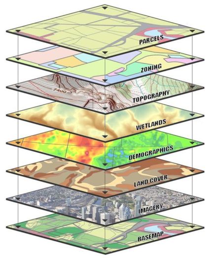
Our team is proficient in using ArcGIS, QGIS, and Global Mapper to manage and analyze exploration data, create interactive maps, and generate reports. This ensures accurate spatial representation, efficient data management, and effective communication of exploration insights for decision-making.

Our Capabilities

  • Satellite Image Interpretation using Landsat, Sentinel, ASTER, and UAV Datasets
    We analyze satellite and UAV imagery to identify geological structures, surface mineral signatures, and potential exploration targets.

  • Thematic and Alteration Mapping for Mineral Potential Zone Identification
    We create thematic and alteration maps to highlight areas with high mineral potential, supporting accurate exploration targeting.

  • Digital Terrain Modeling and GIS Integration of Multi-Disciplinary Data
    We develop digital terrain models (DTMs) and integrate geological, geophysical, and geochemical datasets in GIS for comprehensive spatial analysis.

  • Use of ArcGIS, QGIS, and Global Mapper for Exploration Data Management
    We utilize ArcGIS, QGIS, and Global Mapper to manage, analyze, and visualize exploration data, ensuring efficient workflows and precise mapping.

Why Choose Us

  • • Experienced geospatial analysts with mineral exploration expertise
  • • Advanced remote sensing techniques for accurate geological interpretation
  • • Seamless integration of GIS and multi-disciplinary datasets
  • • Commitment to precision, quality, and actionable exploration insights